Today's Severe Weather Risk
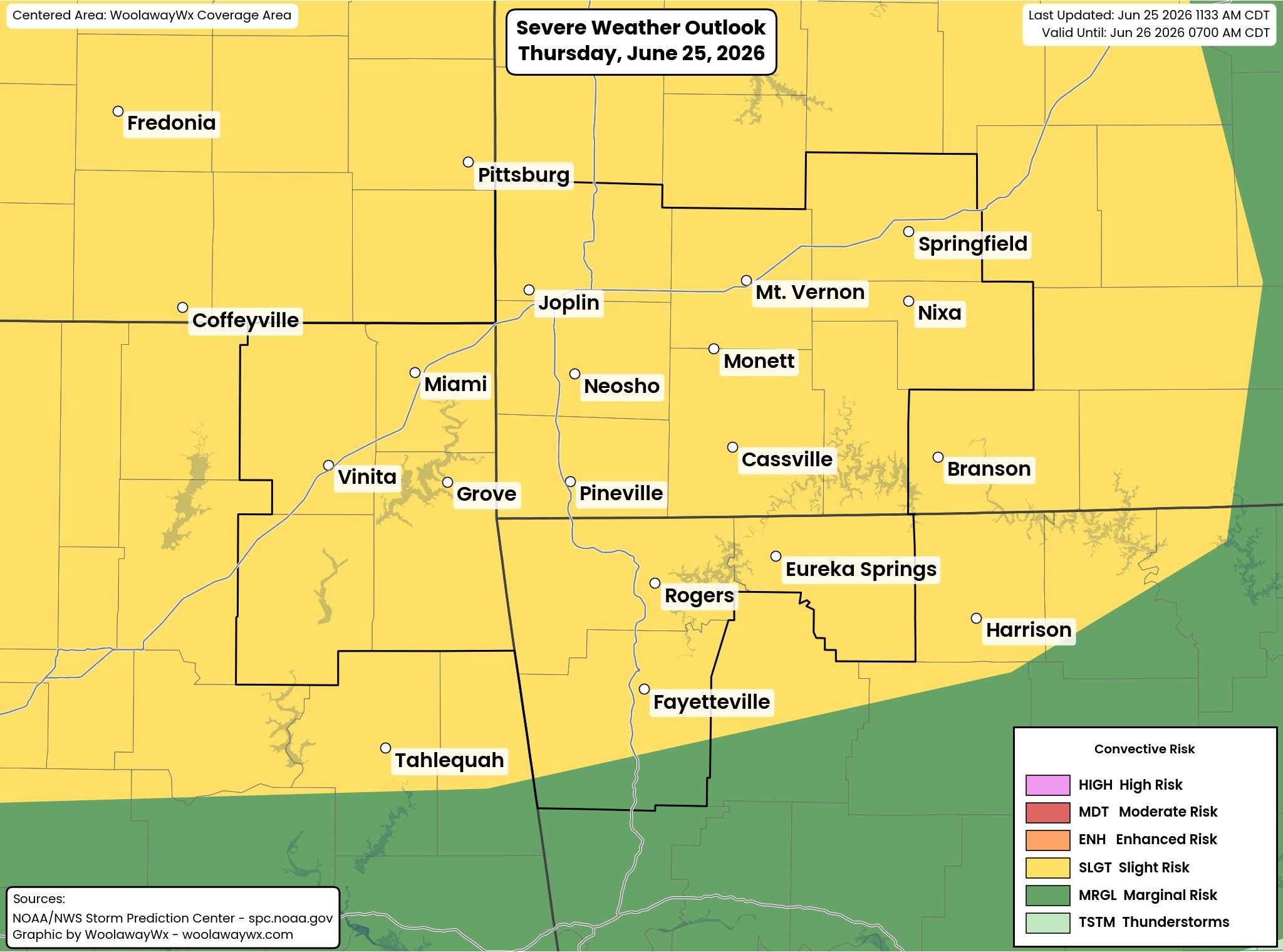
There is a level 2/5 Slight Risk in place for the coverage area for strong to severe storms today, Thursday, June 25th. While all modes of severe weather are possible, damaging winds up to 60% will be the main concern this afternoon and evening hours. A couple of tornadoes, perhaps strong, can not be ruled out, but not expecting tornadoes to be a widespread concern as much as the damaging winds potential.
Severe Weather Risk Breakdown, Listed in order by impact:
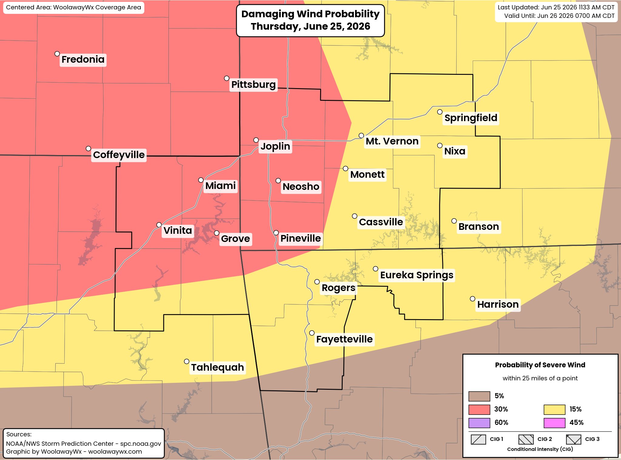
- Damaging Winds: Damaging winds will be the main concern with much of the coverage area being in a 30% chance of seeing 60 mph or greater winds this evening, within 25 miles of a point. While there is no intensity with these winds, the strongest of storms could produce winds up to 70 mph, though the environment is limited in terms of potential over that.
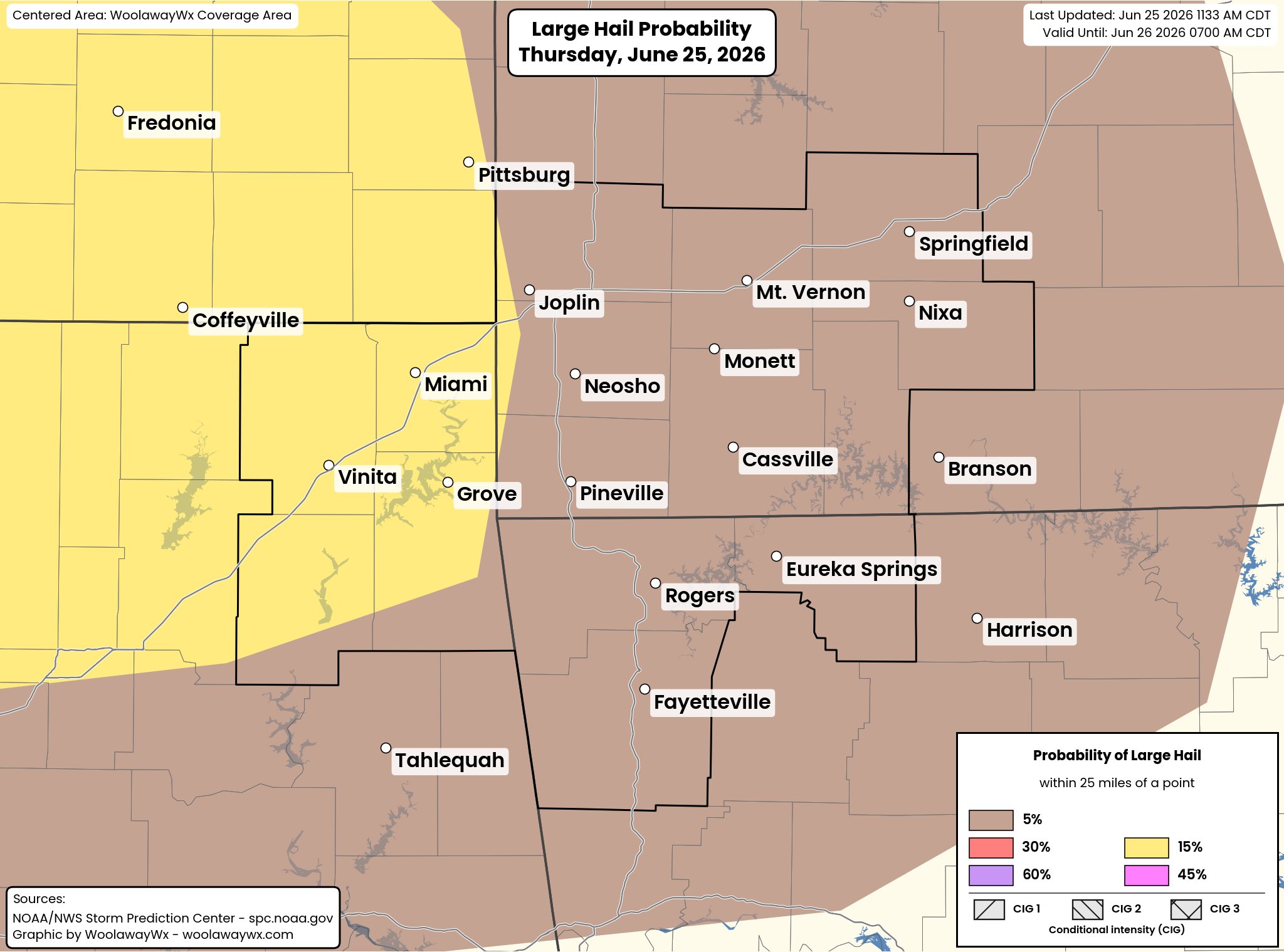
- Large Hail: Large hail isn’t a big concern. The coverage area is in a 5 to 15% risk probability, which means that in the strongest of storms, hail up to an inch (quarter size) will be possible.
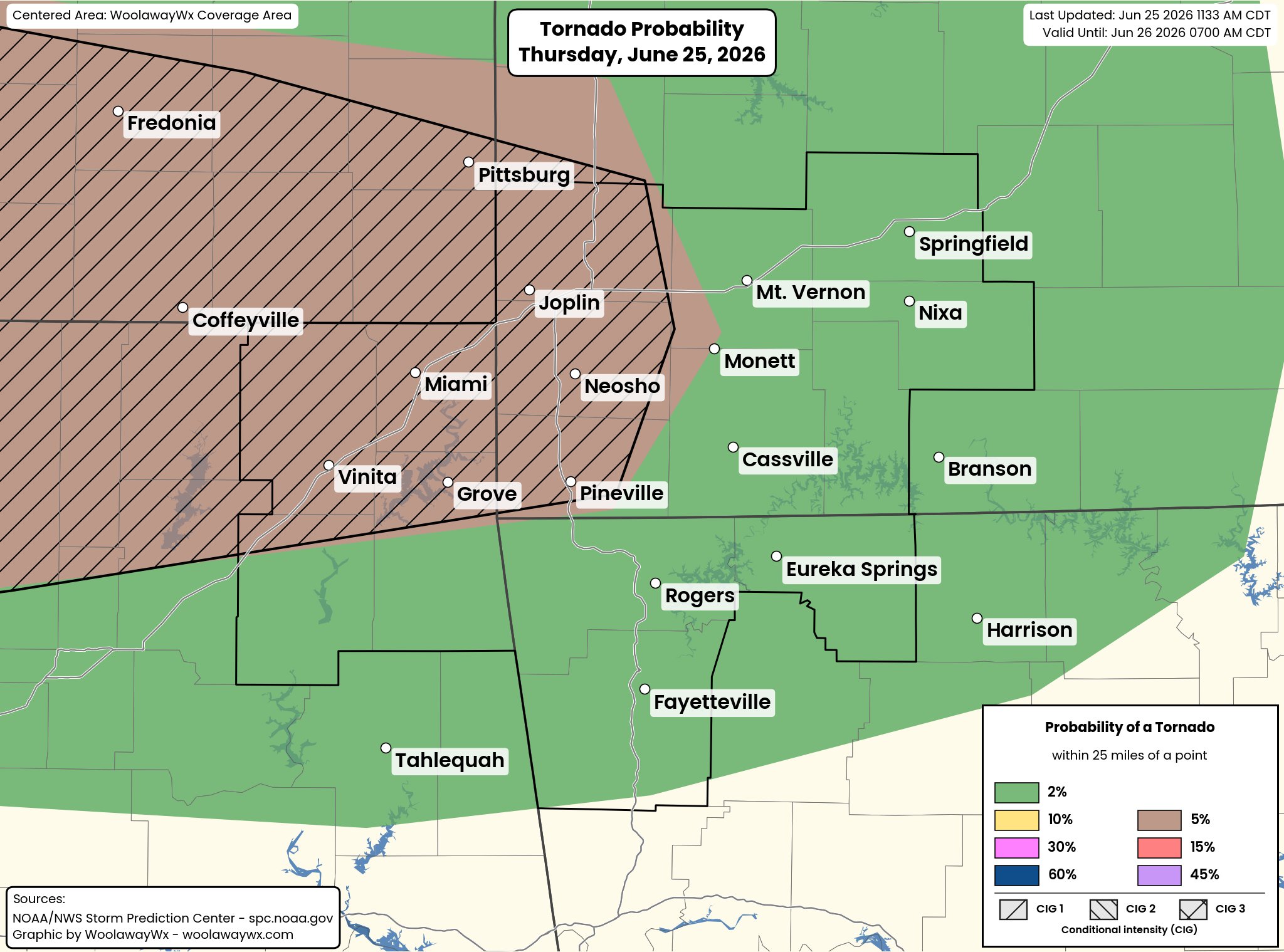
- Tornadoes: The coverage area is split between a 2% and 5%, with the 5% area also having a CIG 1 risk. Not expecting tornadoes to be a widespread concern with the limited probability, but areas within the 5% CIG1 risk will have the greatest (but still limited) potential for a few tornadoes, with the max reasonable intensity being an EF2 tornado.
Flooding Risk:
As in all of the other storm systems lately, flooding is also another concern with this system. Areas that get rainfall repeatedly will have the highest potential for flash flooding late this afternoon and into the evening and overnight hours. Make sure to turn around, and don’t drown!

Timing:
Guidance hasn’t been overly helpful with today's risk. We are already starting to see some blips pop up on the KSGF radar over SWMO and NWA, although not expecting those to do a ton. The main storm chances look to start to increase around the 4 pm hour, and continue through the evening and into the overnight hours, with some guidance suggesting multiple bands/rounds of storms today and tonight. Today will be very much of a day where radar is the best tool we have cause outside of that, we really don't have a ton of help.
Don’t forget to visit and install the WoolawayWx web app and set up alert notifications! Visit https://woolawaywx.com/help/pwa for details on how to install it today!
Make sure to have multiple ways to get alerts for both severe weather and flooding on Sunday and Monday, and have a plan to seek shelter for a severe weather risk, along with a plan to leave if flooding is a common issue in your area.