Round number one impacted the area with just some light wintery weather, but hot much of an impact as most operations continue as normal today. So it is time to talk about round number two.
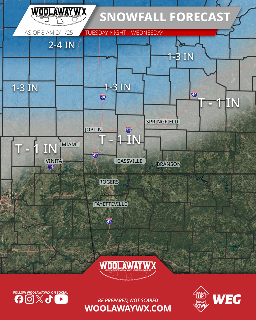
If you are a snow lover, this will likely not make you filled with joy. The overall trend has been pushing warmer temperatures into Southern Missouri, Northwest Arkansas, and Northeast Oklahoma, which has but a damper on accumulations for ice or snow (besides higher elevations where it could be cooler). There are new winter weather advisories for counties that are north of I-44, as that is where the heavier snowfall is expected to occur. Some of the new models that were coming in while making this forecast showed a slight deviation to the south, but there is not much to support that other than the one or two models that showed that variation. I will keep an eye on it, and make updates as needed if that were to start to become a trend across more data sets, but until then, sticking with snow north of I-44, with heavier amounts near and north of US 54. A wintery mix of light snow, sleet, freezing rain, and rain will be possible to areas along and south of I-44, and as you go south towards NWA, the odds of a cold rain increase. Temperatures will be right around the freezing mark while most of this occurs, so will be something to watch incase what is observed is a degree or two colder than forecasted, as that could introduce more of a chance for winter weather. A lot of things to watch as you can see.
If you like the work that I am doing at WoolawayWx, please consider liking the page and post, and sharing the information so more people can be weather prepared. For more ways to support, visit https://www.woolawaywx.com/support.