
From fire risk to severe risk…
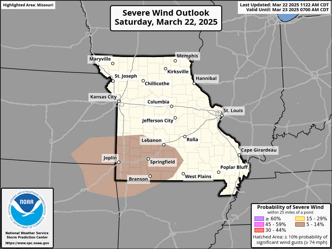
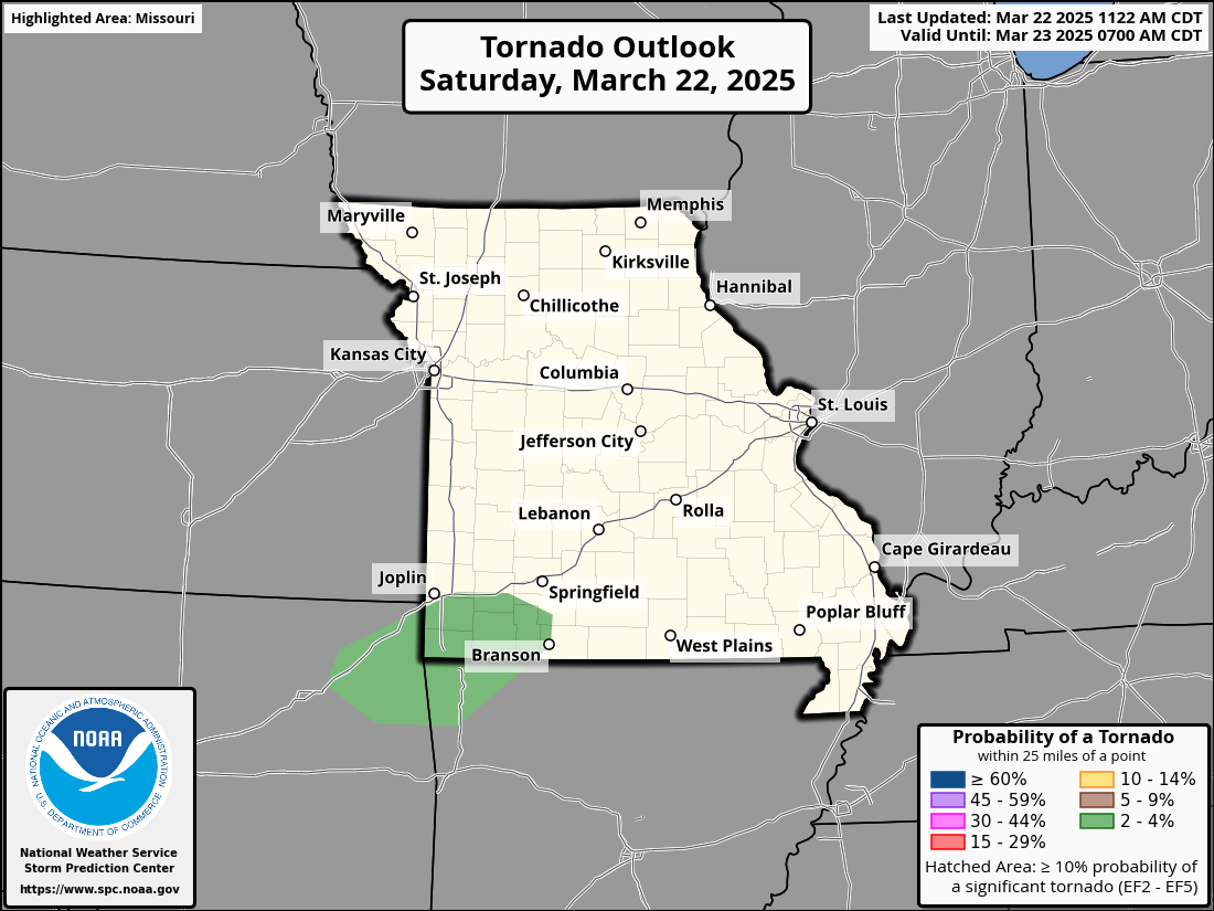
The Storm Prediction Center has issued a Level 2 of 5 Slight Risk for portions of Southwest Missouri, Northwest Arkansas, and Northeast Oklahoma.
This severe weather risk is mainly driven by a 15% damaging hail risk.There is also a 5% damaging wind risk, and a very conditional 2% tornado risk.


The timeline of this system looks to be late this evening, and into the early morning hours of Sunday. Storms look to fire in Oklahoma, and move west. Short range guidance indicates a messy system will storms being individual cells, but due to the moisture that is forecasted to be in the area at this time, the risk for tornados is very low, and very conditional.
Last week's tornadoes to the east and the recent release of a Joplin tornado documentary might have some folks on edge, but I want to put things into perspective. Hearing the word "tornado" doesn't automatically spell disaster. Take a 2% tornado risk, for example, it simply means that any given spot in that risk zone has just a 2% chance of seeing a tornado within 25 miles. That’s a pretty slim chance. Plus, with moisture levels being low right now, it’s an even more conditional threat. That said, don’t sleep on other severe weather risks. Damaging winds and large hail can pack a serious punch too, so it’s smart to stay ready for all possibilities, tornadoes included, without losing sight of the bigger picture. I take tornado risk seriously as I have had many many close encounters with them, along with being personally affected by them so if I feel like there is a concern, I will make sure to note it.
For tonight, make sure to keep up to date with the weather, and monitor for weather alerts, and changes to the forecast.
Be Prepared, Not Scared!