Thursday, January 9th, 2025 at 2 PM | Rocky Comfort, MO
Winter storm Cora is still expected to impact the Ozarks on Thursday and Friday, and bringing up to 8 inches for some of the area.
Current weather advisories are lighting up the map:
- Winter Storm Warning for Carroll, Benton, and Washington counties in Northwest Arkansas until 12 PM Friday.
- Winter Storm Warning for McDonald, Newton, Jasper, Lawrence, Barry, Stone, and Taney counties in Southwest Missouri from 5 PM Thursday till 6 PM on Friday.
- Winter Storm Warning for Craig, Ottawa, Mayes, and Delaware counties in Northeast Oklahoma till 12 PM Friday.
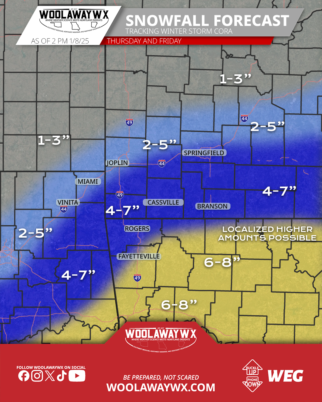
Snowfall totals look to be close to 6-8" inches for Northwest Arkansas. 4-7" for Southwest Missouri and Northeast Oklahoma. Note that these numbers will have some change, and will have outliers on the high and low end. There is a lot of snow banding expected with this system, and those bands of moderate to heavy snowfall are very hard to forecast, while I have faith in keeping close to the same forecast as I had Thursday night, I know it won't be perfect, and I am sure people will get upset about that, but, frankly, let them. Forecasting winter weather is not fun, and not for the faint of heart.
I will likely do another update later in the afternoon or early evening as more data will come in from this point till then. It will likely only be posted on social media channels, and not a blog post.
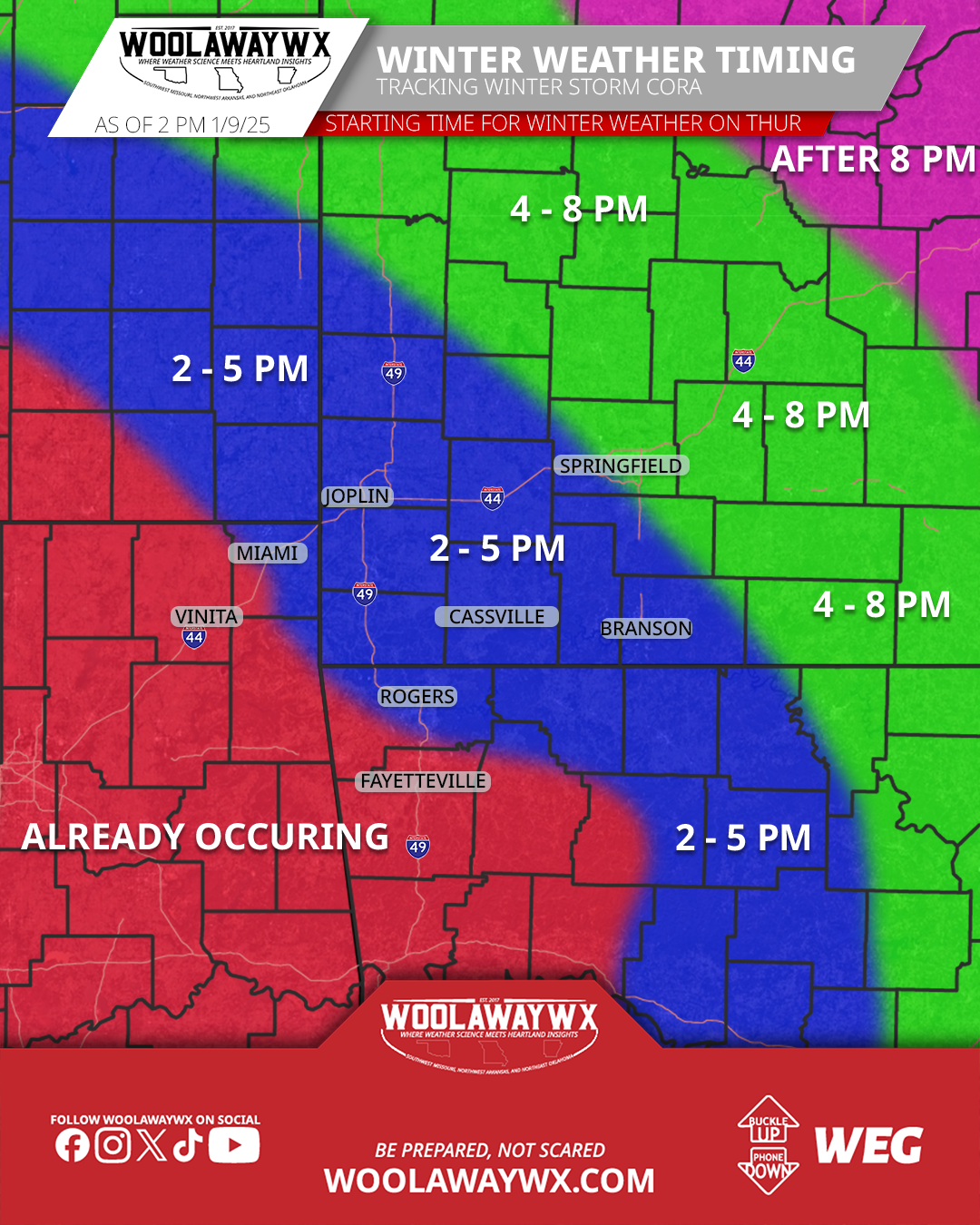
As of this post, snowfall is already occurring in parts of Northwest Arkansas and Northeast Oklahoma, and will likely extend into Southwest Missouri shortly after the time of this post. The system will slowly expand east, north east, kind of following up the I-44 corridor.
I have pushed out a whole new website design that can be found on woolawaywx.com, and features some forecast for snowfall from the NWS, along with the only winter road conditions map that will show you Missouri, Arkansas, Kansas, and Oklahoma at the same time. To view that, go to this link: https://www.woolawaywx.com/weather/winter/roads.
Make sure to monitor for potential changes in the forecast, and follow WoolawayWx on social media platforms. Links to those platforms can be found on the header, or the footer of the website.