Good Morning I suppose is what I need to use.
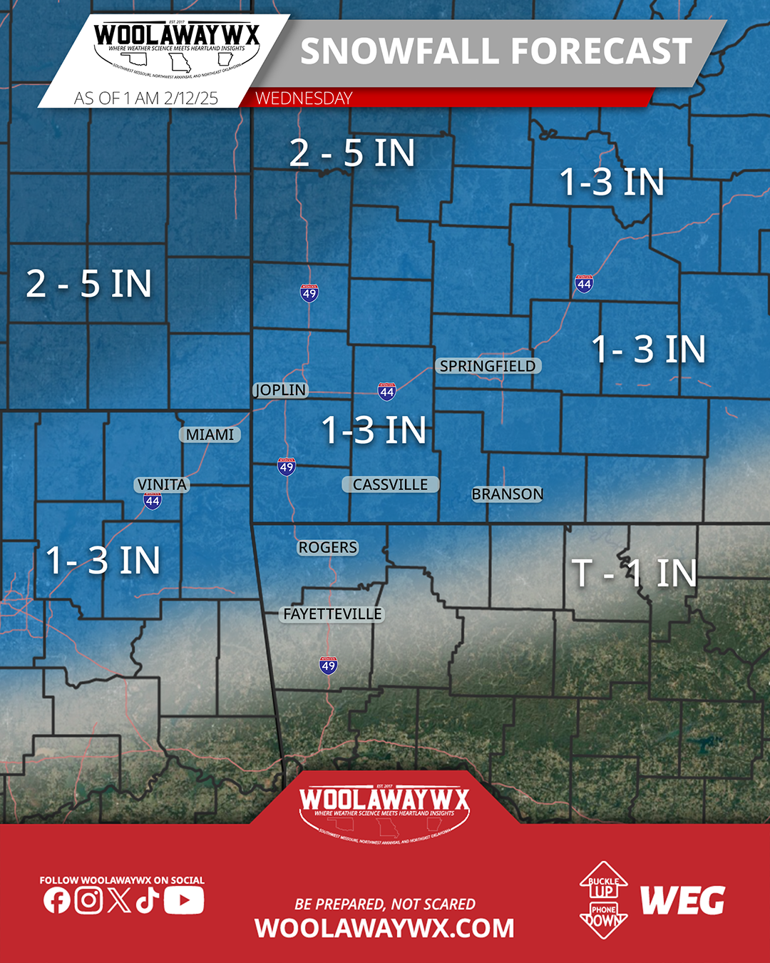
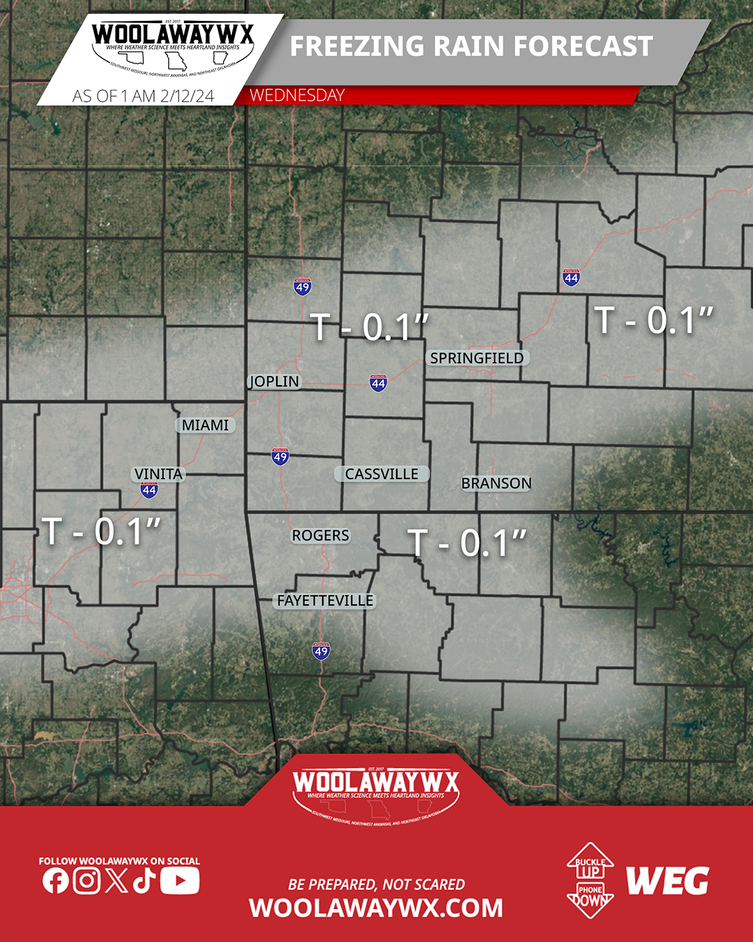
Sleep is for the wicked, they say, so I guess I am wicked (Just kidding, sleep sounds really nice right about now). The latest model guidance has been showing slightly colder temperatures on Wednesday, which will bring some higher snowfall totals to the area. I feel okay enough in terms of confidence as it has been very consistent in terms of the shift; the amounts have bounced a little, but remained in that 1-3" range for most of it. While this does increase the chances for some snowfall that is more than a trace, it doesn't make the ice/sleet risk zero. The forecast is still showing some warmer temperatures in the morning before the system punches into the area, so 5 a.m. - 9 a.m. will be the timeline for the change in precipitation, and also for heavier precipitation amounts where there could be some thundersnow/thundersleet as there is some convective potential to get a few clouds riled up. In terms of impacts to roads and potential for closings, it will be a tight call for many between the time the precipitation starts and the time that schools and businesses open, so expect to have some discussion in the morning from schools and businesses.
Just a reminder that WoolawayWx now has a school closings page, and it can be found at https://woolawaywx.com/closings. I also have a road conditions page to see road conditions across Missouri, Kansas, Oklahoma, and Arkansas, and that can be found at: https://woolawaywx.com/weather/winter/roads.
If you like the work that I am doing at WoolawayWx, please consider liking the page and post, and sharing the information so more people can be weather prepared. For more ways to support, visit https://www.woolawaywx.com/support.